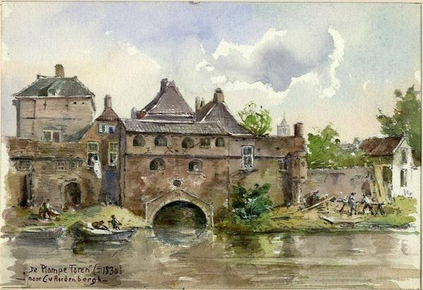
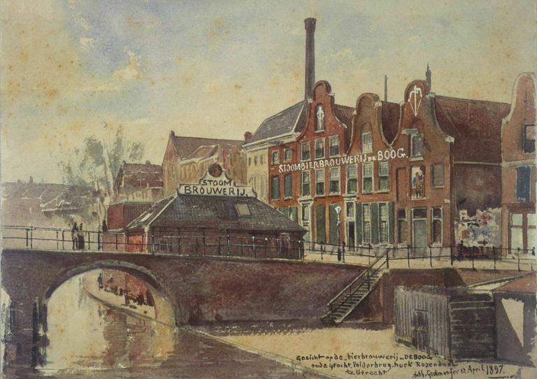
Images Filters Artist Anthony Everhardus Grolman Collection Collection... HET Utrechts Archief (212) Country Country... Netherlands (212) Continent Continent... Europe (212) Medium No options available Category Category... Buildings & Architecture (202) Landscapes & Seascapes (9) Travel & Transport (1) Date Date... 1600-1699 (1) 1810s (1) 1820s (1) 1830s (2) 1840s (2) 1850s (1) 1860s (2) 1870s (7) 1880s (41) 1890s (114) 1900s (17) 1910s (14) Anthony Everhardus Grolman 212 matching results. You may want to refine your search. See slideshow Sort orderRelevanceOldest additions firstNewest additions firstOldest painted firstNewest painted first See results on a map View map View from the factory of Begeer on the Strosteeg, in the direction of the Mariaplaats. With the the St. Joan de Deo hospital in the background. (1880-1915) + Add to album View in the Vinkenburgsteeg from the Neude. (1881) + Add to album View from the Vismarkt of the houses on the west side of the Choorstraat near the Stadhuisbrug with the rebuilding of the houses Choorstraat 2-6, from the east. (30 April 1896) + Add to album View of the Public Primary School on Vlijtstraat (December 1912) + Add to album View of the Oudegracht with the Vollersbrug. With the buildings of De Boog brewery on the corner of the Lange Rozendaal. (12 April 1897) + Add to album View from the Pausdam on the front and side of the Sic Semper society on the corner of the Nieuwegracht and the Trans. (06 February 1890) + Add to album View from the Pausdam on the site of the Sic Semper society on the corner of the Nieuwegracht and the Trans after demolition of the old building. (09 June 1890) + Add to album View of the facade of the House for Military, the former student society P.H.R.M. (Wed 3A), with the adjoining houses, from the northeast. (10 May 1893) + Add to album Dutch Hospital for Ooglijders (12 June 1894) + Add to album The town hall (Stadhuisbrug): the Municipal Museum of Antiquities on the second floor: room F. (27 May 1889) + Add to album View of the Vredenburg in with a cicus tent behind the theater and the buildings of the W.H gas plant, from the east. (1885) + Add to album The house behind the Dom F 316 and a part of No. 316a with the Voetiussteeg on the left. (March 1879) + Add to album Interior of the Nicolaikerk in Utrecht: the main organ against the west wall. (February 1885) + Add to album Interior of the town hall (Stadhuisbrug) in Utrecht: the Municipal Museum of Antiquities on the second floor: room C. (22 May 1889) + Add to album Interior of the town hall (Stadhuisbrug): the Municipal Museum of Antiquities on the second floor (03 June 1889) + Add to album Interior of the town hall (Stadhuisbrug). the Municipal Museum of Antiquities on the second floor. (02 August 1889) + Add to album Interior of the town hall (Stadhuisbrug) in Utrecht: the Municipal Museum of Antiquities on the second floor: room H. (11 July 1889) + Add to album View of the southeast corner of the Mariakerk junction with the houses built later on, from the west. (1886) + Add to album View of the Bijlhouwerstoren in Utrecht, during the demolition, from the northeast. (22 August 1872) + Add to album View of the Oudegracht with the Vollersbrug. With the buildings of De Boog brewery on the corner of the Lange Rozendaal. (1893) + Add to album View of the rear facades of the houses of Zadelstraat in Utrecht on the Buurkerkhof. (1894) + Add to album View from the corner of the Lijnmarkt and the Zadelstraat. (27 June 1890) + Add to album View from the Stadhuisbrug in front of the clothing store of J.B. Schröder (13 January 1896) + Add to album The facade of the Oudegracht 133 house in Utrecht on the corner of the Bakkersteeg (left) and the Hamsteeg (right). (1885) + Add to album View over the Stadsbuitengracht of the Stadwal, with the mouth of the Plompetorengracht and to the right the partially demolished city wall with the spietor turret (1825-1830) + Add to album View over the outer canal at the Physiological Laboratory of the Faculty of Medicine of the University of Utrecht. (1897) + Add to album View of the facade of the Welgelegen house in 1871 (1871-1915) + Add to album View over the city outer canal on the northern part of the Wittevrouwensingel in Utrecht, from the southeast. (14 August 1881) + Add to album View over the Stadsbuitengracht of the Abstederbrug, from the northeast (05 April 1890) + Add to album View of the Nederlandsch Gasthuis for 'the Needy and Blind'. (June 1894) + Add to album The facades of the houses on the south side of the Wittevrouwenstraat in Utrecht from the northeast, with the entrance to the Rietsteeg on the left. (December 1897) + Add to album Houses at Biltstraat 60-66 (north side) with the 'fire spray house' No. 6 in the middle. (1905) + Add to album View in the Boothstraat in Utrecht from the north in the direction of the Janskerk. (1892) + Add to album View of the facades of the Neude 13 -18 houses, some of which are part of the Rijksmunt complex (Oudegracht Weerdzijde 108). (1895) + Add to album View of the gas factory of W.H. de Heus on Vredenburg in Utrecht, from the north. (1859) + Add to album Meadows to the west of Utrecht before the construction of the Croeselaan, with trees along the Leidseweg and the Bijgeval and De Ster mills, from the southeast (17 May 1883) + Add to album The side and front of the Lepelenburg 1 house, the home of the Vlaer and Kol banking family. (December 1897) + Add to album View from the Ezelsdijk between the Blauwkapelseweg and the Biltsche Grift. (11 April 1883) + Add to album View from the Begijnekade 16 house on the city outer canal. (1888) + Add to album The landscape around the Kwakkeldijk outside the city of Utrecht. (14 May 1883) + Add to album Along the Zwarte Water (1879) + Add to album View of the landscape around the Zwarte Water, outside the city of Utrecht (1883) + Add to album The city of Utrecht from the Kwakkeldijk. (1880) + Add to album View of the Zwarte Water in Utrecht with two locks, from the northeast. (16 June 1881) + Add to album Southern part of the Westerstroom with the Westerbrug and the Westerdijk. (28 October 1893) + Add to album View of the residential tower and other buildings of Den Ham castle in Vleuten. (30 June 1879) + Add to album View of the Vleutenswetering in Utrecht with the farm Het Ooievaarsnest, from the northwest. (18 October 1889) + Add to album View of the Stadsbuitengracht from the southeast at the Lange Smeestraat, with the Willemsbrug in the background (04 July 1887) + Add to album View of a gardener's house on the Het Hogeland site at the Oudwijkerlaan in Utrecht, with the trees around the house Het Hogeland in the background. (05 June 1883) + Add to album View of some cargo ships in the Vecht in Utrecht near the Rodebrug. (27 June 1887) + Add to album View over the Kruisvaart (the Tweede Moesgracht) from the southwest. With the Leidseweg and the barracks of the field artillery. (07 June 1883) + Add to album View of the front of the Statenkamer at Janskerkhof in Utrecht before the renovation, with a corner of the anatomy room on the left. (May 1895) + Add to album View from the Korte Jansstraat (October 1906) + Add to album Korte Jansstraat in 1896 (1896) + Add to album View from the Korte Jansstraat of the facades of the Oudkerkhof before the demolition of houses for the widening of the Domstraat. (February 1905) + Add to album View from the Nobelstraat in the Zonstraat in the direction of the Janskerkhof. Before the demolition of the houses for the widening of the Zonstraat. (06 March 1889) + Add to album View from the Zonstraat in the Keizerstraat before demolition of the shop/residence the baker PH van Gendt, for the widening of the street. (06 March 1889) + Add to album View from the Janskerkhof over the Stammetsbrug in the Zonstraat after the demolition of the corner house for the widening of the Zonstraat. (06 March 1889) + Add to album View of the Kromme Nieuwegracht in Utrecht (1880) + Add to album View of the entrance to the caretaker's house of the House of the German Order at the Hofpoort, Nieuwegracht 7-9. (1910) + Add to album 1234Next Last View from the factory of Begeer on the Strosteeg, in the direction of the Mariaplaats. With the the St. Joan de Deo hospital in the background. (1880-1915) Image courtesy HET Utrechts Archief | Publiek Domein 1.0 View in the Vinkenburgsteeg from the Neude. (1881) Image courtesy HET Utrechts Archief | Publiek Domein 1.0 View from the Vismarkt of the houses on the west side of the Choorstraat near the Stadhuisbrug with the rebuilding of the houses Choorstraat 2-6, from the east. (30 April 1896) Image courtesy HET Utrechts Archief | Publiek Domein 1.0 View of the Public Primary School on Vlijtstraat (December 1912) Image courtesy HET Utrechts Archief | Publiek Domein 1.0 View of the Oudegracht with the Vollersbrug. With the buildings of De Boog brewery on the corner of the Lange Rozendaal. (12 April 1897) Image courtesy HET Utrechts Archief | Publiek Domein 1.0 View from the Pausdam on the front and side of the Sic Semper society on the corner of the Nieuwegracht and the Trans. (06 February 1890) Image courtesy HET Utrechts Archief | Publiek Domein 1.0 View from the Pausdam on the site of the Sic Semper society on the corner of the Nieuwegracht and the Trans after demolition of the old building. (09 June 1890) Image courtesy HET Utrechts Archief | Publiek Domein 1.0 View of the facade of the House for Military, the former student society P.H.R.M. (Wed 3A), with the adjoining houses, from the northeast. (10 May 1893) Image courtesy HET Utrechts Archief | Publiek Domein 1.0 Dutch Hospital for Ooglijders (12 June 1894) Image courtesy HET Utrechts Archief | Publiek Domein 1.0 The town hall (Stadhuisbrug): the Municipal Museum of Antiquities on the second floor: room F. (27 May 1889) Image courtesy HET Utrechts Archief | Publiek Domein 1.0 View of the Vredenburg in with a cicus tent behind the theater and the buildings of the W.H gas plant, from the east. (1885) Image courtesy HET Utrechts Archief | Publiek Domein 1.0 The house behind the Dom F 316 and a part of No. 316a with the Voetiussteeg on the left. (March 1879) Image courtesy HET Utrechts Archief | Publiek Domein 1.0 Interior of the Nicolaikerk in Utrecht: the main organ against the west wall. (February 1885) Image courtesy HET Utrechts Archief | Publiek Domein 1.0 Interior of the town hall (Stadhuisbrug) in Utrecht: the Municipal Museum of Antiquities on the second floor: room C. (22 May 1889) Image courtesy HET Utrechts Archief | Publiek Domein 1.0 Interior of the town hall (Stadhuisbrug): the Municipal Museum of Antiquities on the second floor (03 June 1889) Image courtesy HET Utrechts Archief | Publiek Domein 1.0 Interior of the town hall (Stadhuisbrug). the Municipal Museum of Antiquities on the second floor. (02 August 1889) Image courtesy HET Utrechts Archief | Publiek Domein 1.0 Interior of the town hall (Stadhuisbrug) in Utrecht: the Municipal Museum of Antiquities on the second floor: room H. (11 July 1889) Image courtesy HET Utrechts Archief | Publiek Domein 1.0 View of the southeast corner of the Mariakerk junction with the houses built later on, from the west. (1886) Image courtesy HET Utrechts Archief | Publiek Domein 1.0 View of the Bijlhouwerstoren in Utrecht, during the demolition, from the northeast. (22 August 1872) Image courtesy HET Utrechts Archief | Publiek Domein 1.0 View of the Oudegracht with the Vollersbrug. With the buildings of De Boog brewery on the corner of the Lange Rozendaal. (1893) Image courtesy HET Utrechts Archief | Publiek Domein 1.0 View of the rear facades of the houses of Zadelstraat in Utrecht on the Buurkerkhof. (1894) Image courtesy HET Utrechts Archief | Publiek Domein 1.0 View from the corner of the Lijnmarkt and the Zadelstraat. (27 June 1890) Image courtesy HET Utrechts Archief | Publiek Domein 1.0 View from the Stadhuisbrug in front of the clothing store of J.B. Schröder (13 January 1896) Image courtesy HET Utrechts Archief | Publiek Domein 1.0 The facade of the Oudegracht 133 house in Utrecht on the corner of the Bakkersteeg (left) and the Hamsteeg (right). (1885) Image courtesy HET Utrechts Archief | Publiek Domein 1.0 View over the Stadsbuitengracht of the Stadwal, with the mouth of the Plompetorengracht and to the right the partially demolished city wall with the spietor turret (1825-1830) Image courtesy HET Utrechts Archief | Publiek Domein 1.0 View over the outer canal at the Physiological Laboratory of the Faculty of Medicine of the University of Utrecht. (1897) Image courtesy HET Utrechts Archief | Publiek Domein 1.0 View of the facade of the Welgelegen house in 1871 (1871-1915) Image courtesy HET Utrechts Archief | Publiek Domein 1.0 View over the city outer canal on the northern part of the Wittevrouwensingel in Utrecht, from the southeast. (14 August 1881) Image courtesy HET Utrechts Archief | Publiek Domein 1.0 View over the Stadsbuitengracht of the Abstederbrug, from the northeast (05 April 1890) Image courtesy HET Utrechts Archief | Publiek Domein 1.0 View of the Nederlandsch Gasthuis for 'the Needy and Blind'. (June 1894) Image courtesy HET Utrechts Archief | Publiek Domein 1.0 The facades of the houses on the south side of the Wittevrouwenstraat in Utrecht from the northeast, with the entrance to the Rietsteeg on the left. (December 1897) Image courtesy HET Utrechts Archief | Publiek Domein 1.0 Houses at Biltstraat 60-66 (north side) with the 'fire spray house' No. 6 in the middle. (1905) Image courtesy HET Utrechts Archief | Publiek Domein 1.0 View in the Boothstraat in Utrecht from the north in the direction of the Janskerk. (1892) Image courtesy HET Utrechts Archief | Publiek Domein 1.0 View of the facades of the Neude 13 -18 houses, some of which are part of the Rijksmunt complex (Oudegracht Weerdzijde 108). (1895) Image courtesy HET Utrechts Archief | Publiek Domein 1.0 View of the gas factory of W.H. de Heus on Vredenburg in Utrecht, from the north. (1859) Image courtesy HET Utrechts Archief | Publiek Domein 1.0 Meadows to the west of Utrecht before the construction of the Croeselaan, with trees along the Leidseweg and the Bijgeval and De Ster mills, from the southeast (17 May 1883) Image courtesy HET Utrechts Archief | Publiek Domein 1.0 The side and front of the Lepelenburg 1 house, the home of the Vlaer and Kol banking family. (December 1897) Image courtesy HET Utrechts Archief | Publiek Domein 1.0 View from the Ezelsdijk between the Blauwkapelseweg and the Biltsche Grift. (11 April 1883) Image courtesy HET Utrechts Archief | Publiek Domein 1.0 View from the Begijnekade 16 house on the city outer canal. (1888) Image courtesy HET Utrechts Archief | Publiek Domein 1.0 The landscape around the Kwakkeldijk outside the city of Utrecht. (14 May 1883) Image courtesy HET Utrechts Archief | Publiek Domein 1.0 Along the Zwarte Water (1879) Image courtesy HET Utrechts Archief | Publiek Domein 1.0 View of the landscape around the Zwarte Water, outside the city of Utrecht (1883) Image courtesy HET Utrechts Archief | Publiek Domein 1.0 The city of Utrecht from the Kwakkeldijk. (1880) Image courtesy HET Utrechts Archief | Publiek Domein 1.0 View of the Zwarte Water in Utrecht with two locks, from the northeast. (16 June 1881) Image courtesy HET Utrechts Archief | Publiek Domein 1.0 Southern part of the Westerstroom with the Westerbrug and the Westerdijk. (28 October 1893) Image courtesy HET Utrechts Archief | Publiek Domein 1.0 View of the residential tower and other buildings of Den Ham castle in Vleuten. (30 June 1879) Image courtesy HET Utrechts Archief | Publiek Domein 1.0 View of the Vleutenswetering in Utrecht with the farm Het Ooievaarsnest, from the northwest. (18 October 1889) Image courtesy HET Utrechts Archief | Publiek Domein 1.0 View of the Stadsbuitengracht from the southeast at the Lange Smeestraat, with the Willemsbrug in the background (04 July 1887) Image courtesy HET Utrechts Archief | Publiek Domein 1.0 View of a gardener's house on the Het Hogeland site at the Oudwijkerlaan in Utrecht, with the trees around the house Het Hogeland in the background. (05 June 1883) Image courtesy HET Utrechts Archief | Publiek Domein 1.0 View of some cargo ships in the Vecht in Utrecht near the Rodebrug. (27 June 1887) Image courtesy HET Utrechts Archief | Publiek Domein 1.0 View over the Kruisvaart (the Tweede Moesgracht) from the southwest. With the Leidseweg and the barracks of the field artillery. (07 June 1883) Image courtesy HET Utrechts Archief | Publiek Domein 1.0 View of the front of the Statenkamer at Janskerkhof in Utrecht before the renovation, with a corner of the anatomy room on the left. (May 1895) Image courtesy HET Utrechts Archief | Publiek Domein 1.0 View from the Korte Jansstraat (October 1906) Image courtesy HET Utrechts Archief | Publiek Domein 1.0 Korte Jansstraat in 1896 (1896) Image courtesy HET Utrechts Archief | Publiek Domein 1.0 View from the Korte Jansstraat of the facades of the Oudkerkhof before the demolition of houses for the widening of the Domstraat. (February 1905) Image courtesy HET Utrechts Archief | Publiek Domein 1.0 View from the Nobelstraat in the Zonstraat in the direction of the Janskerkhof. Before the demolition of the houses for the widening of the Zonstraat. (06 March 1889) Image courtesy HET Utrechts Archief | Publiek Domein 1.0 View from the Zonstraat in the Keizerstraat before demolition of the shop/residence the baker PH van Gendt, for the widening of the street. (06 March 1889) Image courtesy HET Utrechts Archief | Publiek Domein 1.0 View from the Janskerkhof over the Stammetsbrug in the Zonstraat after the demolition of the corner house for the widening of the Zonstraat. (06 March 1889) Image courtesy HET Utrechts Archief | Publiek Domein 1.0 View of the Kromme Nieuwegracht in Utrecht (1880) Image courtesy HET Utrechts Archief | Publiek Domein 1.0 View of the entrance to the caretaker's house of the House of the German Order at the Hofpoort, Nieuwegracht 7-9. (1910) Image courtesy HET Utrechts Archief | Publiek Domein 1.0