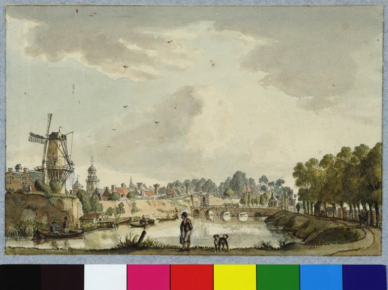
Images Filters Artist Jan de Beyer Collection Collection... HET Utrechts Archief (115) Rijksmuseum (20) British Museum (2) Detroit Institute of Arts (1) Royal Collection Trust (1) The Courtauld Gallery (1) Country Country... Netherlands (136) Germany (4) Continent Continent... Europe (140) Medium Medium... Watercolour (13) Print (1) Category Category... Buildings & Architecture (130) Landscapes & Seascapes (9) People & Society (1) Date Date... 1700s (2) 1710s (5) 1720s (5) 1730s (49) 1740s (80) 1750s (32) 1760s (11) 1770s (5) 1780s (4) 1820s (1) 1830s (5) 1840s (1) Jan de Beyer 140 matching results. You may want to refine your search. See slideshow Sort orderRelevanceOldest additions firstNewest additions firstOldest painted firstNewest painted first See results on a map View map View of the Oudegracht from the northeast. With houses on the Stadhuisbrug and the houses on the Vismarkt. (1735-1750) + Add to album View over the outer city canal of the Wittevrouwenpoort and bridge, from the north. (1736-1740) + Add to album Image of the Bisschopshof in Utrecht, from the courtyard. (1740-1750) + Add to album View of the Oudegracht from the southwest, with the Bezembrug, the city crane, the houses Blijdestein, Rutenberg, Keyserrijk and De Ster. (1736-1750) + Add to album View of the Oudegracht from the northwest with the Bakker Bridge, Putruwiel house, Groot Groenewoude, and the Dom tower. (1736-1750) + Add to album View of the Jacobi bridge across the Oudegracht from the south. (1736-1750) + Add to album View of the village of Doorn. (14 July 1750) + Add to album The village of Driebergen with St. Catherine's chapel and The Prince of Orange lodgings. (1750-1755) + Add to album View of the stadsvolmolen on the northeast corner of the Bemuurde Weerd at the mouth (behind the lock) of the Oosterstroom in the Zwarte Water. (1744-1745) + Add to album The Stadsbuitengracht. With the bastion Sterrenburg, the Smeetoren, towers of the Geertekerk, the Buurkerk, Domtoren and the Catharijnesingel, from the south. (1736) + Add to album View from the Begijnebolwerk on the north-east side of the city with the De Beer tower, behind it the Plompetoren and in the background the De Vos tower. (1736) + Add to album View from the city wall to the Leeuwenberggasthuis on the Schalkwijksteeg. With the Bruntskameren and the Groot Lepelenburg, from the southeast. (1744) + Add to album The Achter Clarenburg riding school, from the west. With the former St. Elisabeth guesthouse on Vredenburg and partial facades of houses on Achter Clarenburg. (1736-1750) + Add to album View from the northeast from the new factory in the garden of the Zijdebalen house on the Vecht over the Westerstroom with the domes of Mineral and Seashells (16 September 1745) + Add to album View from the southwest from the Speelhuis in the garden of the Zijdebalen house. With the domes of Mineral and Seashells from the Berceaux. (16 September 1745) + Add to album View from the Turkish tent on the duck pond in the garden of the Zijdebalen house on the Vecht in Utrecht, from the northwest. (26 August 1745) + Add to album View from the theater in the garden of the Zijdebalen house on the Vecht. (23 August 1745) + Add to album View into the garden of the Zijdebalen house on the Vecht in Utrecht from the southwest, over the Droge Kom. (06 September 1745) + Add to album View into the garden of the Zijdebalen house on the Vecht in Utrecht from the southwest, across the ground floor on the Bergje, towards the house. (26 August 1745) + Add to album View into the garden of the Zijdebalen house on the Vecht from the southwest. (25 August 1745) + Add to album View over the pond in the garden of the Zijdebalen house on the Vecht. With the factory, orangery, 'green screens' and Triumphal arch. (20 August 1745) + Add to album The Kromme Nieuwegracht with the chapel of the St.-Hieronymus house and on the left the gateway to the Latin School, from the north. (1744) + Add to album The courtyard of the German House on Springweg from the southeast, with on the left the main building and on the right the old and the new commander's house. (20 August 1744) + Add to album View of the Catharijnesteeg from the Lange Nieuwstraat, with St. Catherine's Church on the right (05 September 1744) + Add to album View of the Jacobikerk on the Jacobskerkhof from the southeast. (22 August 1744) + Add to album View of the Buurkerk on Buurkerkhof from the southeast. (1744) + Add to album The Maria Church from the northeast. (1736-1740) + Add to album View of the Janskerk on the Janskerkhof from the southwest, with the Hoofdwacht on the left of the church. (24 September 1744) + Add to album View of the Pieterskerk, from the southwest (22 August 1744) + Add to album View of the Dom tower from the Zadelstraat, at the intersection with the Choorstraat and the Lijnmarkt (1746) + Add to album View of the ruins of the nave of the Domkerk from the east (1745) + Add to album View from the ramparts over the Stadsbuitengracht on the northwest corner of the Begijnebolwerk in Utrecht from the west. (1744) + Add to album View across the city outer canal on the northwest corner of the Begijnebolwerk, with the Leeuw tower in the background. (1744) + Add to album View across the outer canal from the north, with the Wolf towers (rear left) and the Vos. (1744) + Add to album View over the outer city canal of the Wittevrouwenpoort and bridge, from the north. (1736-1750) + Add to album The outer canal with the Wittevrouwenpoort and bridge, from the north. With the Wittevrouwensingel on the left and the Hond tower on the right. (1736-1750) + Add to album View from the canal across the Stadsbuitengracht from the west. (August 1736) + Add to album View over the outer city canal of the Wittevrouwenpoort and bridge, from the north. (1736) + Add to album View across the outer city canal on the Catharijnepoort and bridge, from the south. (1736) + Add to album View across the outer city canal from the north. With the stronghold Lepelenburg, Malie bridge and gate. (1744) + Add to album View from Stadsbuitengracht on the Stadwal from the southeast. With the tower on the Servaashek and the Bastion Zonnenburg. (1735-1750) + Add to album View over the outer city canal with the Tolsteeg bridge, Bijlhouwerstoren and the bastion Manenburg. (1744) + Add to album View from across the Stadsbuitengracht in Utrecht of the Sterrenburg bastion and the windmill on the Bijlhouwerstoren, from the southwest. (27 September 1744) + Add to album View over the outer city canal from the south. With the singel, Smeetoren, Geertekerk, Dom tower and the Sterrenburg bastion. (27 September 1744) + Add to album The outer canal from the south. With the Smeetoren, Geertekerk, tower of the Buurkerk and the Domtoren, and bastion Sterrenburg with De Sprokkel mill. (1736) + Add to album View over the Stadsbuitengracht of the Stadwal from the south. With the Smeetoren, tower of the Geertekerk and bastion Sterrenburg with De Sprokkel mill. (1736) + Add to album View over the Stadsbuitengracht on the Stadwal with the Mariawaterpoortje on the right, and De Fortuin mill in the background. (1736) + Add to album Profile of the city of Utrecht seen from the northwest, somewhere between the Daalsedijk and the Vecht. (1745) + Add to album View over the Zwarte Water from the southwest, with the mill yard of the Haas sawmill. (1737-1739) + Add to album View of the southeast corner of Vredenburg. (1737) + Add to album View of the southeast side of Vredenburg in Utrecht. (1736) + Add to album View over the Vaartsche Rijn with the sawmill 'in sail' (1737-1739) + Add to album North side of the Pausdam. With corner house of the Trans and the houses on Achter St.-Pieter. (September 1736) + Add to album View from the east side of the Oudegracht at the Weesbrug (03 September 1744) + Add to album The Oudegracht in from the southwest. With the Bezembrug, the city crane and houses Blijdestein, Rutenberg, Keijserrijk and De Ster. (1737) + Add to album The Oudegracht with the Bezembrug and the city crane. With facades of the houses Blijdestein, Rutenberg, Keijserrijk and De Ster. (1735-1750) + Add to album The Oudegracht from the north. With houses on the Stadhuisbrug and the Vismarkt. (1736) + Add to album View of the Oudegracht from the southwest with the Bezembrug and the city crane (1736) + Add to album View of the Oudegracht near the Stadhuisbrug, in the background the houses on the Vismarkt and the Dom tower. (1736) + Add to album View of the Oudegracht between Jansbrug and Stadhuisbrug. With the Bakkerbrug, Putruwiel house, Groenewoude house and the Dom tower. (1736) + Add to album 123Next Last View of the Oudegracht from the northeast. With houses on the Stadhuisbrug and the houses on the Vismarkt. (1735-1750) Image courtesy HET Utrechts Archief | Publiek Domein 1.0 View over the outer city canal of the Wittevrouwenpoort and bridge, from the north. (1736-1740) Image courtesy HET Utrechts Archief | Publiek Domein 1.0 Image of the Bisschopshof in Utrecht, from the courtyard. (1740-1750) Image courtesy HET Utrechts Archief | Publiek Domein 1.0 View of the Oudegracht from the southwest, with the Bezembrug, the city crane, the houses Blijdestein, Rutenberg, Keyserrijk and De Ster. (1736-1750) Image courtesy HET Utrechts Archief | Publiek Domein 1.0 View of the Oudegracht from the northwest with the Bakker Bridge, Putruwiel house, Groot Groenewoude, and the Dom tower. (1736-1750) Image courtesy HET Utrechts Archief | Publiek Domein 1.0 View of the Jacobi bridge across the Oudegracht from the south. (1736-1750) Image courtesy HET Utrechts Archief | Publiek Domein 1.0 View of the village of Doorn. (14 July 1750) Image courtesy HET Utrechts Archief | Publiek Domein 1.0 The village of Driebergen with St. Catherine's chapel and The Prince of Orange lodgings. (1750-1755) Image courtesy HET Utrechts Archief | Publiek Domein 1.0 View of the stadsvolmolen on the northeast corner of the Bemuurde Weerd at the mouth (behind the lock) of the Oosterstroom in the Zwarte Water. (1744-1745) Image courtesy HET Utrechts Archief | Publiek Domein 1.0 The Stadsbuitengracht. With the bastion Sterrenburg, the Smeetoren, towers of the Geertekerk, the Buurkerk, Domtoren and the Catharijnesingel, from the south. (1736) Image courtesy HET Utrechts Archief | Publiek Domein 1.0 View from the Begijnebolwerk on the north-east side of the city with the De Beer tower, behind it the Plompetoren and in the background the De Vos tower. (1736) Image courtesy HET Utrechts Archief | Publiek Domein 1.0 View from the city wall to the Leeuwenberggasthuis on the Schalkwijksteeg. With the Bruntskameren and the Groot Lepelenburg, from the southeast. (1744) Image courtesy HET Utrechts Archief | Publiek Domein 1.0 The Achter Clarenburg riding school, from the west. With the former St. Elisabeth guesthouse on Vredenburg and partial facades of houses on Achter Clarenburg. (1736-1750) Image courtesy HET Utrechts Archief | Publiek Domein 1.0 View from the northeast from the new factory in the garden of the Zijdebalen house on the Vecht over the Westerstroom with the domes of Mineral and Seashells (16 September 1745) Image courtesy HET Utrechts Archief | Publiek Domein 1.0 View from the southwest from the Speelhuis in the garden of the Zijdebalen house. With the domes of Mineral and Seashells from the Berceaux. (16 September 1745) Image courtesy HET Utrechts Archief | Publiek Domein 1.0 View from the Turkish tent on the duck pond in the garden of the Zijdebalen house on the Vecht in Utrecht, from the northwest. (26 August 1745) Image courtesy HET Utrechts Archief | Publiek Domein 1.0 View from the theater in the garden of the Zijdebalen house on the Vecht. (23 August 1745) Image courtesy HET Utrechts Archief | Publiek Domein 1.0 View into the garden of the Zijdebalen house on the Vecht in Utrecht from the southwest, over the Droge Kom. (06 September 1745) Image courtesy HET Utrechts Archief | Publiek Domein 1.0 View into the garden of the Zijdebalen house on the Vecht in Utrecht from the southwest, across the ground floor on the Bergje, towards the house. (26 August 1745) Image courtesy HET Utrechts Archief | Publiek Domein 1.0 View into the garden of the Zijdebalen house on the Vecht from the southwest. (25 August 1745) Image courtesy HET Utrechts Archief | Publiek Domein 1.0 View over the pond in the garden of the Zijdebalen house on the Vecht. With the factory, orangery, 'green screens' and Triumphal arch. (20 August 1745) Image courtesy HET Utrechts Archief | Publiek Domein 1.0 The Kromme Nieuwegracht with the chapel of the St.-Hieronymus house and on the left the gateway to the Latin School, from the north. (1744) Image courtesy HET Utrechts Archief | Publiek Domein 1.0 The courtyard of the German House on Springweg from the southeast, with on the left the main building and on the right the old and the new commander's house. (20 August 1744) Image courtesy HET Utrechts Archief | Publiek Domein 1.0 View of the Catharijnesteeg from the Lange Nieuwstraat, with St. Catherine's Church on the right (05 September 1744) Image courtesy HET Utrechts Archief | Publiek Domein 1.0 View of the Jacobikerk on the Jacobskerkhof from the southeast. (22 August 1744) Image courtesy HET Utrechts Archief | Publiek Domein 1.0 View of the Buurkerk on Buurkerkhof from the southeast. (1744) Image courtesy HET Utrechts Archief | Publiek Domein 1.0 The Maria Church from the northeast. (1736-1740) Image courtesy HET Utrechts Archief | Publiek Domein 1.0 View of the Janskerk on the Janskerkhof from the southwest, with the Hoofdwacht on the left of the church. (24 September 1744) Image courtesy HET Utrechts Archief | Publiek Domein 1.0 View of the Pieterskerk, from the southwest (22 August 1744) Image courtesy HET Utrechts Archief | Publiek Domein 1.0 View of the Dom tower from the Zadelstraat, at the intersection with the Choorstraat and the Lijnmarkt (1746) Image courtesy HET Utrechts Archief | Publiek Domein 1.0 View of the ruins of the nave of the Domkerk from the east (1745) Image courtesy HET Utrechts Archief | Publiek Domein 1.0 View from the ramparts over the Stadsbuitengracht on the northwest corner of the Begijnebolwerk in Utrecht from the west. (1744) Image courtesy HET Utrechts Archief | Publiek Domein 1.0 View across the city outer canal on the northwest corner of the Begijnebolwerk, with the Leeuw tower in the background. (1744) Image courtesy HET Utrechts Archief | Publiek Domein 1.0 View across the outer canal from the north, with the Wolf towers (rear left) and the Vos. (1744) Image courtesy HET Utrechts Archief | Publiek Domein 1.0 View over the outer city canal of the Wittevrouwenpoort and bridge, from the north. (1736-1750) Image courtesy HET Utrechts Archief | Publiek Domein 1.0 The outer canal with the Wittevrouwenpoort and bridge, from the north. With the Wittevrouwensingel on the left and the Hond tower on the right. (1736-1750) Image courtesy HET Utrechts Archief | Publiek Domein 1.0 View from the canal across the Stadsbuitengracht from the west. (August 1736) Image courtesy HET Utrechts Archief | Publiek Domein 1.0 View over the outer city canal of the Wittevrouwenpoort and bridge, from the north. (1736) Image courtesy HET Utrechts Archief | Publiek Domein 1.0 View across the outer city canal on the Catharijnepoort and bridge, from the south. (1736) Image courtesy HET Utrechts Archief | Publiek Domein 1.0 View across the outer city canal from the north. With the stronghold Lepelenburg, Malie bridge and gate. (1744) Image courtesy HET Utrechts Archief | Publiek Domein 1.0 View from Stadsbuitengracht on the Stadwal from the southeast. With the tower on the Servaashek and the Bastion Zonnenburg. (1735-1750) Image courtesy HET Utrechts Archief | Publiek Domein 1.0 View over the outer city canal with the Tolsteeg bridge, Bijlhouwerstoren and the bastion Manenburg. (1744) Image courtesy HET Utrechts Archief | Publiek Domein 1.0 View from across the Stadsbuitengracht in Utrecht of the Sterrenburg bastion and the windmill on the Bijlhouwerstoren, from the southwest. (27 September 1744) Image courtesy HET Utrechts Archief | Publiek Domein 1.0 View over the outer city canal from the south. With the singel, Smeetoren, Geertekerk, Dom tower and the Sterrenburg bastion. (27 September 1744) Image courtesy HET Utrechts Archief | Publiek Domein 1.0 The outer canal from the south. With the Smeetoren, Geertekerk, tower of the Buurkerk and the Domtoren, and bastion Sterrenburg with De Sprokkel mill. (1736) Image courtesy HET Utrechts Archief | Publiek Domein 1.0 View over the Stadsbuitengracht of the Stadwal from the south. With the Smeetoren, tower of the Geertekerk and bastion Sterrenburg with De Sprokkel mill. (1736) Image courtesy HET Utrechts Archief | Publiek Domein 1.0 View over the Stadsbuitengracht on the Stadwal with the Mariawaterpoortje on the right, and De Fortuin mill in the background. (1736) Image courtesy HET Utrechts Archief | Publiek Domein 1.0 Profile of the city of Utrecht seen from the northwest, somewhere between the Daalsedijk and the Vecht. (1745) Image courtesy HET Utrechts Archief | Publiek Domein 1.0 View over the Zwarte Water from the southwest, with the mill yard of the Haas sawmill. (1737-1739) Image courtesy HET Utrechts Archief | Publiek Domein 1.0 View of the southeast corner of Vredenburg. (1737) Image courtesy HET Utrechts Archief | Publiek Domein 1.0 View of the southeast side of Vredenburg in Utrecht. (1736) Image courtesy HET Utrechts Archief | Publiek Domein 1.0 View over the Vaartsche Rijn with the sawmill 'in sail' (1737-1739) Image courtesy HET Utrechts Archief | Publiek Domein 1.0 North side of the Pausdam. With corner house of the Trans and the houses on Achter St.-Pieter. (September 1736) Image courtesy HET Utrechts Archief | Publiek Domein 1.0 View from the east side of the Oudegracht at the Weesbrug (03 September 1744) Image courtesy HET Utrechts Archief | Publiek Domein 1.0 The Oudegracht in from the southwest. With the Bezembrug, the city crane and houses Blijdestein, Rutenberg, Keijserrijk and De Ster. (1737) Image courtesy HET Utrechts Archief | Publiek Domein 1.0 The Oudegracht with the Bezembrug and the city crane. With facades of the houses Blijdestein, Rutenberg, Keijserrijk and De Ster. (1735-1750) Image courtesy HET Utrechts Archief | Publiek Domein 1.0 The Oudegracht from the north. With houses on the Stadhuisbrug and the Vismarkt. (1736) Image courtesy HET Utrechts Archief | Publiek Domein 1.0 View of the Oudegracht from the southwest with the Bezembrug and the city crane (1736) Image courtesy HET Utrechts Archief | Publiek Domein 1.0 View of the Oudegracht near the Stadhuisbrug, in the background the houses on the Vismarkt and the Dom tower. (1736) Image courtesy HET Utrechts Archief | Publiek Domein 1.0 View of the Oudegracht between Jansbrug and Stadhuisbrug. With the Bakkerbrug, Putruwiel house, Groenewoude house and the Dom tower. (1736) Image courtesy HET Utrechts Archief | Publiek Domein 1.0